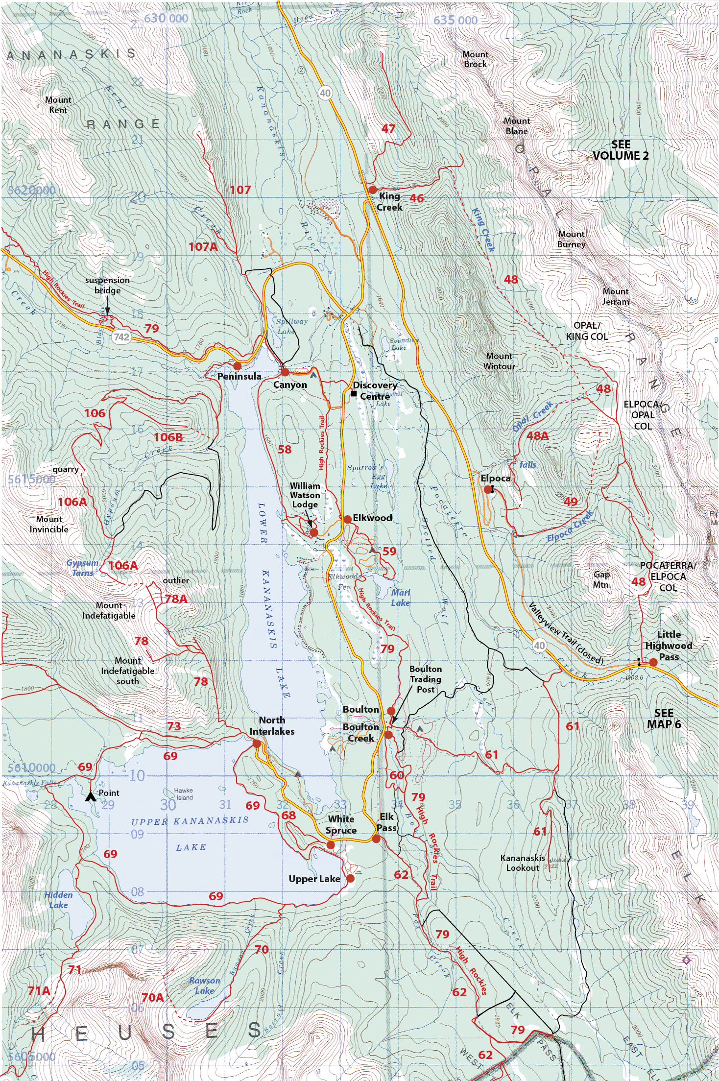
KING CREEK RIDGE
Distance 7.0 km return, height gain 731 m, strenuous
Start: Hwy. 40 (Kananaskis Trail) at King Creek day-use area.
Difficulty: The new and improved trail (see guidebook) up the west flank is still a sweaty grunt on a hot day.
Note: The descent to the north fork is difficult and not reccommended. The fork itself is reported as an "arduous journey over giant boulders, deadfall & gravel walls to rock hop & repeated creek-crossings towards the canyon as the trail is 98% gone post flooding. The 3 1/2 km leg took about 3 hours."
Map: Kananaskis Lakes

Please refer to the trail description in the guidebook, especially for unofficial, off-trail hikes.
Kananaskis Country Trail Guide Volume 1, 2023 Trail #47
Trailhead: King Creek 50.7173N, -115.10795W
Last updated Aug 23, 2018
Use browsers back button to select another trail in the same area.