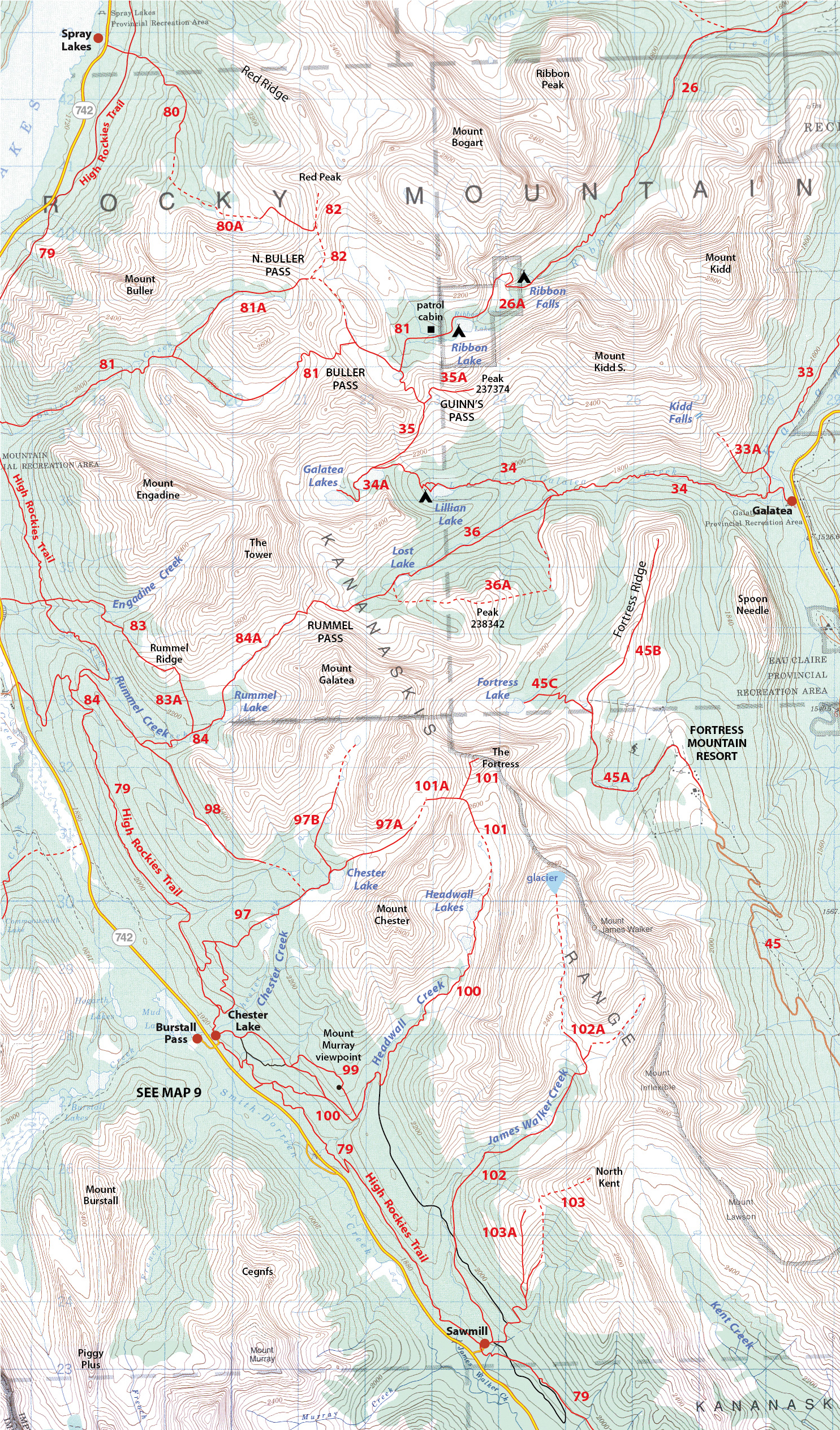
JAMES WALKER CREEK
Distance 9.0 km return, height gain 300 m, fairly easy
Start: Hwy. 742 (Smith-Dorrien/Spray Trail) at Sawmill day-use area.
Difficulty: Old logging roads followed by a good trail. The trail is in good condition as of Aug. 2022. Keep to the right (east) side of the first lake. The trail up the headwall is easy to follow, but has some large-diameter deadfall.
Biking the logging roads saves time.
Note: At the far end of James Walker Lake, the inlet stream is now flowing in a new channel. The old stream-bed has become a great bit of trail up to the first little cascade of the “waterfall” section of the valley. After the first waterfall, the upper trail is unchanged from previous years.
Map: Fortress-Chester
 The lake below the headwall.
Please refer to the trail description in the guidebook, especially for unofficial, off-trail hikes.
Kananaskis Country Trail Guide Volume 1, 2023 Trail #102
Trailhead: Sawmill 50.74858N, -115.24575W
Last updated Aug 25, 2022
Use browsers back button to select another trail in the same area.