
In his first email after the storm Alf said: “My estimate is that around 1,500 trees fell across trails in the WBC network. A significant number of the downed trees are the largest-oldest trees in the area. It seems that the tallest trees, with the largest canopy were the ones that broke under the gusting pressure of the wind.” He continued: “The XC ski trails had the fewest downed trees, in part because many of the trails are aligned with the westerly wind and partly because they are in the lower, sheltered areas between ridges.
Boundary Ridge is one of the worst hit areas with an incredible jumble of downed trees requiring skilled chainsaw operators to cut through them safely.
West Bragg volunteers, assisting the AEP-Public Lands crew, have been out at WBC since Dec 2, and have put in long days (including a Sunday) clearing the trails. About 300 trees were removed from the XC ski trails and all except Telephone have now been groomed and trackset. Logical loops of multi-use trails have been cleared, with the AEP crew dealing with any trees that are too big or too hazardous for volunteers to tackle — leaners, partly broken, split or sprung trees.
They have even roped in Calgary ATV Riders Association volunteers to clear downed trees on Tom Snow trail, from Dawson PRA to Kestrel Junction. It’s great to see the co-operation within the local outdoor community.
Gill sent Alf some photos of windthrow on Deer Ridge trail and in his reply Alf said: I just got back an hour ago from the 20th day of tree removal by West Bragg volunteers and AEP teams. So many downed trees… and similar to your photos, a high percentage of the downed trees are very large and often shattered from the trunk at metres off the ground. Our count of trees cleared from the trail is now at just over 1,250 trees. We have not even started to clear most of the ridge sections of trails like Sugar Mama, Sugar Daddy, Bobcat, Ranger Summit, Boundary or Kestrel. I expect that the total number of trees down will be well over 2,000.
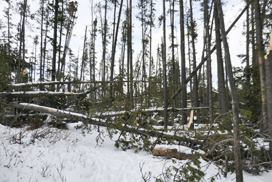
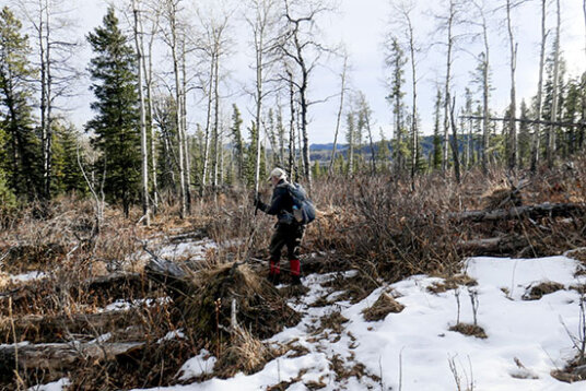
A wall of downed trees prevented us hiking up Boundary Ridge trail from the junction where Boundary Horse heads into the cutblock.
So the next day we hiked Boundary Horse trail to see the damage for ourselves! Wow. When we reached the junction where Boundary Horse heads into the cutblock we tried to detour up the main Boundary Ridge trail. There was a wall of downed trees. Climbing onto one there was windthrow as far as we could see up the trail. What a mess!
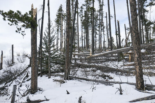
A few trees remain standing at the high point of Boundary Ridge. Waiting for the next big windstorm to remove them?
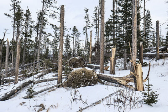
We hiked up the cutblock with no problem, observing the deadfalls all up the edge of the block. Surprisingly there were still a few trees standing at the highpoint, but far fewer than before. We headed down to the gate in the drift fence and regained the main Boundary Ridge trail. Again a solid wall of windthrow to the north. The trail to the south seemed a little clearer as we followed it a way to find a spot out of the wind for lunch.
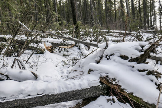
The view along Boundary Ridge trail from the cut-through from the gate in the drift fence on Boundary Horse.
It’s many years since a windstorm like this one has impacted the Elbow/West Bragg region. The worst storm we remember was in the late eighties/early nineties. I distinctly remember coming across an elderly gentleman wielding a chainsaw attacking a head-high wall of large downed spruce somewhere around the junction of Elbow Valley and Sulphur Springs trails. He had been at it for several days. If you look at Google Earth you will see a large area just north of the Moose Mountain Road lower parking lot that contains a lot of old deadfalls. The new MMBTS Stones Throw trail cuts across a corner of the area. The destruction of a large area such as this within the overall forest was probably caused by a microburst (see later).
Trying to follow the line of Stones Throw through the vast old deadfall area earlier this year.
My memory of other areas affected by that storm is somewhat hazy. Most of the current West Bragg trails did not exist then, but I remember a lot of blowdown on Demi-Tel and round the corner of Reconnect. It was several years before that was cleared by a keen skier who checked the trail every Fall. I think the deadfall across the Lusk Creek trail north of the current connector trail came from the same storm. Again it was may years before it was cleared, I think by Parks.
The meteorology of such events is not clear with studies done and theories put forth by meteorologists, foresters and silviculturists. There appears to be two different processes — gust fronts and widespread gusty winds — both affected by topography and forest cover.
Gust fronts are the leading edge of cool air that interacts with warmer air and often results in a narrow band of straight-line wind. Microbursts, small concentrated downburst that produces an outward burst of strong winds at or near the surface, may touch down causing extensive damage. The wind burst will typically last a few seconds to a few minutes. Older trees, especially ones with a large canopy, or trees such as aspens will be snapped off at their weakest point, while shallow-rooted trees such as spruce or fir will be ripped out complete with roots. Trees may all be laid out in the same direction, or if there is a cyclonic component to the microburst may end up pointing in different directions.
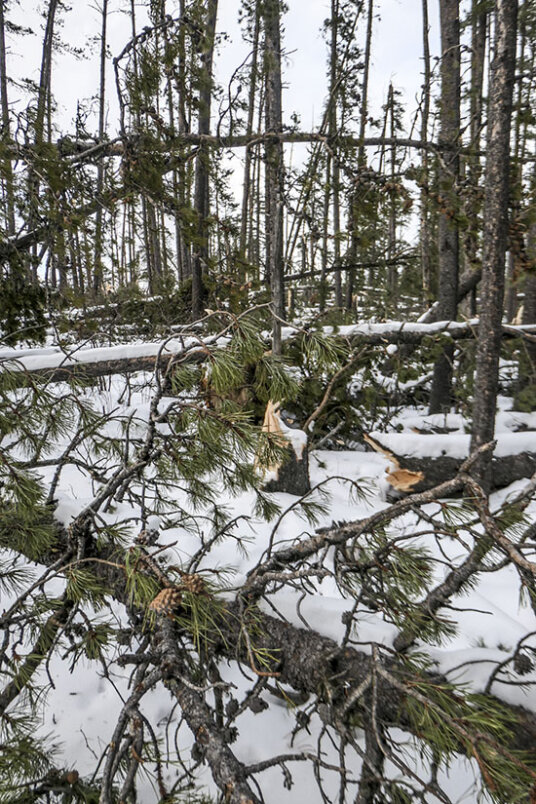
Some trees snap off at their weakest point, while others are downed with their roots attached.
On the other hand widespread gusty winds cause most damage at the edge of open areas such as cutblocks or on open ridges. Gusty winds typically rock a tree back and forth until the tree is in such a position that the next gust either snaps it off or rips it out complete with roots. I suspect that both of these processes can happen during a major wind storm
A wind gust, possibly a microburst, appears to be responsible for a few large downed spruce in thick forest 3-400 m before Boundary Horse meets up with Boundary Ridge. There’s no discernible clearing, but somehow the wind found its way down through the canopy.
There has been quite a bit of research done by foresters on minimizing windstorm damage as a result of logging. There appears to be no simple solution. Shape and orientation of cutbacks may help, but is dependant on topography. Selective logging opens up the canopy to microbursts. Long, narrow strips of logging have been suggested but are unlikely to work in the varied topography of the Alberta foothills.
Hopefully, when the future planned logging occurs at West Bragg, the lessons learned from this storm will help minimize the effect of gusty winds on the trail system. Perhaps leaving the tops of ridges with trails bare, rather than providing a buffer of trees would help prevent another Boundary Ridge debacle.

Comments on this entry are closed.
The damage in our foothills was probably caused by a long-lived linear windstorm similar to a derecho. While the official US definition of a derecho is a wind storm that extends 650 km and is at least 100 km wide, our storm had very similar characteristics, including a gust front and microbursts. The National Oceanic and Atmospheric Administration has a comprehensive web page on derechos if you wish to peruse this subject further.
https://spc.noaa.gov/misc/AbtDerechos/derechofacts.htm
An aquantance in West Bragg Creek recorded 193 km/h winds on his weather station that day. That was in a valley…
The summit area of Boundary Ridge is proving a bummer. It’s already May and the crew are still figuring out where best to reroute the trail. Right now it’s using some of Boundary Horse in the meadow. So for now just follow flagging on the reroutes,
Dave. Thanks for you efforts on Ole Buck and Deer Ridge. We watched your Ole Buck video yesterday.
As of the Family Day weekend (Feb 19-21st) The only trails at West Bragg that have not been cleared are Kestrel and Long Distance north of Disconnect. A mammoth effort by West Bragg volunteers and AEP trail crews involving over 2,400 fallen trees.
Wonder where everyone is going on Sunday? Just to let you know that Deer Ridge Loop has also suffered blowdowns, not as bad as those on Boundary Ridge as you can get through or go around the bad bits. Re 9999 trail in the bottom cutblock, solitary trees left standing have blown down across the trail. So again, you’ll be forced into reroutes.