
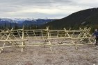
Scrub the old trail from the Elbow-Sheep cutoff off your list. Thanks to a local outfitter we now have a much better trail starting another 540 m along the cutoff at a cairn at 430149. The route is exactly 500 m longer, but on the plus side it misses out the slopes torn up by grizzlies and has a good tread throughout. No more searching for the route. It’s perfect then? Not quite. In thickets of dense spruce the branches need a good trim, or else a reroute should be looked for.

New trail junction on Elbow-Sheep cut-off.

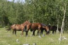
Going up the right side of the ridge.
The first part heads southeast through the odd thicket and up onto a grassy ridge. The second part turns south up the right side of the ridge to a viewpoint, then continues up the left side through larches to meadows above the lake. Here the trail wends left and down to camping spots at the egress. This is now the most distinct trail coming into the lake from this direction.

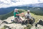
Looking from the viewpoint toward Tombstone Pass.

Where the trail crosses to the left side of the ridge and climbs through larches.

The lake and most northerly peaks of Mount Rea.
Distance along Elbow-Sheep Cutoff 1.2 km. Length of new trail 1.7 km. From Tombstone campground, 3.8 km and from Highway 40, 8.2 km.


Comments on this entry are closed.
Wondering if anyone has done the “abandoned” trail since the gates opened last week? We did the “new” trail this week, and agreed, the spruces could do with a bit of pruning… and though its not as steep as the old trail, we thought that the old trail was perhaps, a bit more scenic? Just wondering if that bit at the bottom of the gulley will deteriorate and become impassible if it’s no longer being used…..
I agree. The trail is NOT abandoned, people are still using it. I have no idea why Tony used that word on the map. Wishful thinking perhaps. So Sid, maybe you can tell us what state that trail is presently in? Thanks.
in the above map one trail to Rae Lk marked as “abandoned”. We took it yesterday, didn’t seem abandoned to us