
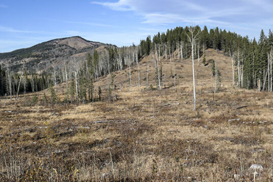
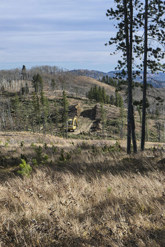
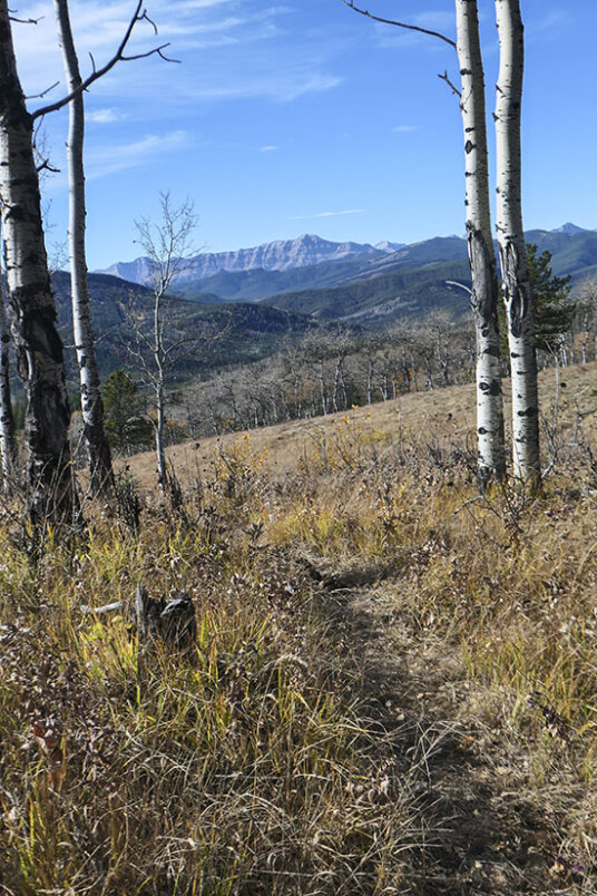
This loop, which includes the middle top of Aspen Ridge, makes a very pleasant alternative to the popular Sinnot Ridge hike. Of course, with all the aspens, the optimum time to visit is late September. But go at any time of the year. After selective logging in 2021 we now have westerly views all year round from the first and middle tops. The third top (Aspen Viewpoint in the 4th edition) is unchanged. What has changed are the hillsides north of 9999 pass which were extensively logged at the same time. But on the plus side 9999 trail is still followable though the terrain looks a little different. Go round either way.
First get onto 9999 trail, either at the K Country boundary from Highway 549 via Curly Sand trail (creek crossing) or from the Caledonian installation (small building) on the pipeline right-of-way off Ware Creek Road (no creek crossing).
Considerations in winter when snow covers the trails.
1. Threepoint Creek on the the Curly Sand access will be frozen. 2. The Caledonian Installation access on Ware Creek road is only 500 m in from Highway 549 so this makes the distance the same as that from the Curly Sand access. 3. It‘s a good idea to walk the single track bike trail Tegan‘s neato without snow as there is no signage of any kind en route and it helps to know the line of it.
Going anti-clockwise from the Caledonian building.
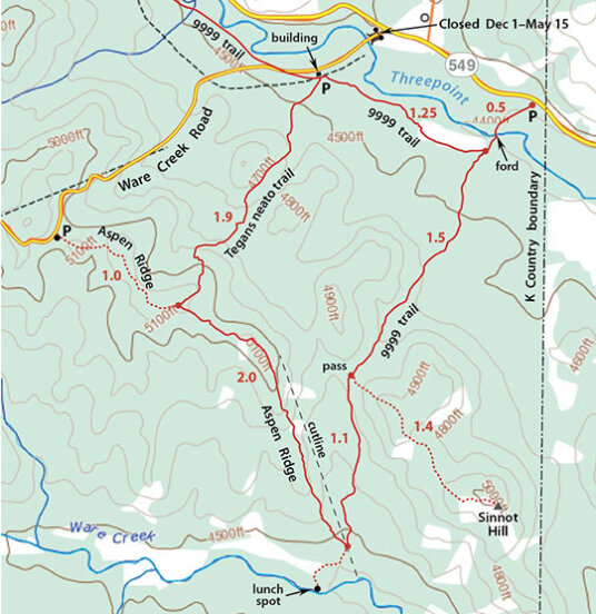
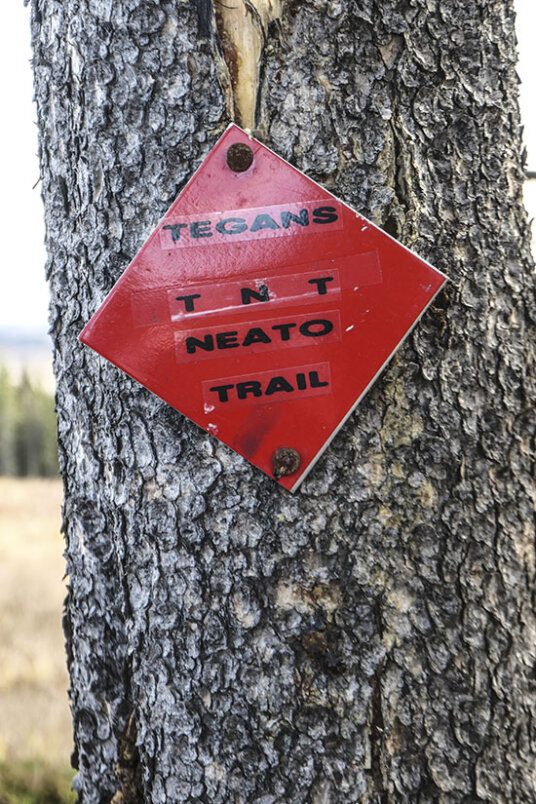
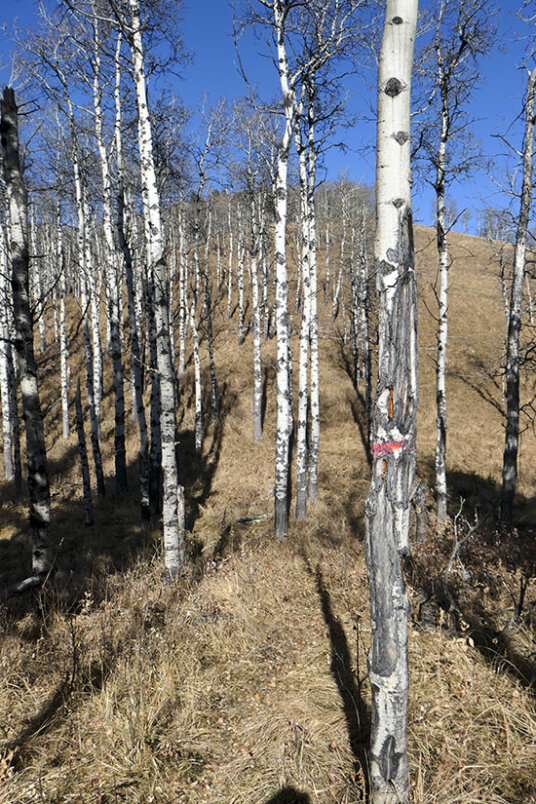
Just southwest of the installation a grassy track heads left. At its entrance, Tegan’s Neato trail heads into the bush. Look for a white sign a little way in within sight of the building. Shortly the trail enters meadows and stays there for 90% of the route, passing between hills, crossing three boardwalks, then climbing up a side ridge that connects with the middle top. It’s a lovely route and at the top is a red trail marker affixed to a tree.
With your back to the Caledonian building you are looking straight at the start of the trail.
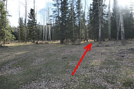
The white trail sign at the start. A few more trees and you are on open slopes.
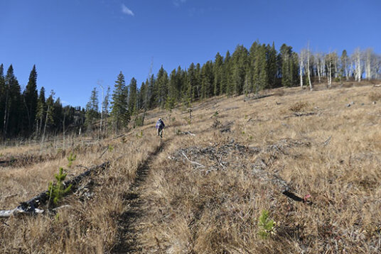
The trail heading between two hills.
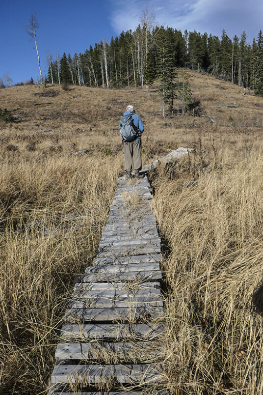
The boardwalk section.beyond the gap between hills. Looking back to number 1 hill. The trail passes below it to the right.
Looking back from the foot of the side ridge to number 1 hill at centre. From here the trail makes rising traverse through a few trees, then winds up the open west slope of the ridge to its crest, from where it’s a flat walk onto the middle top of Aspen Ridge.
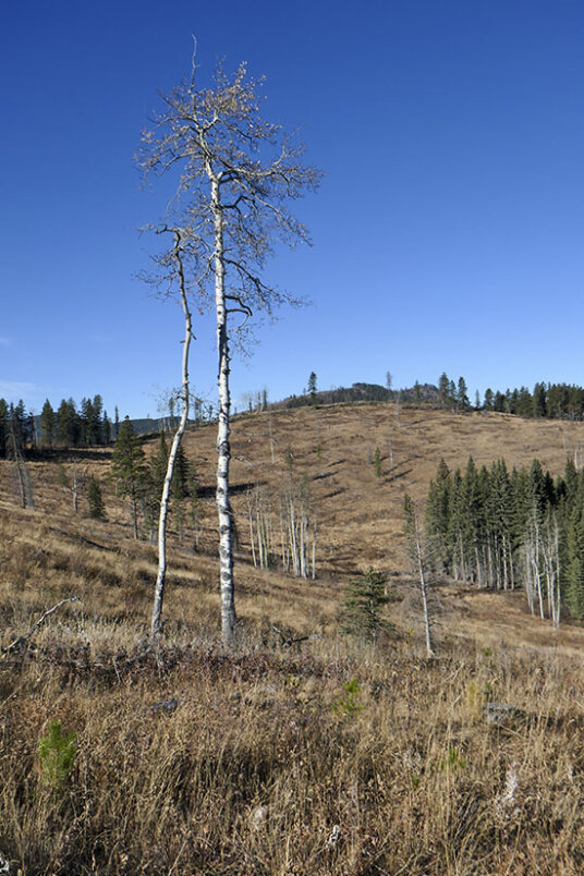
Almost on the crest of the side ridge is a view looking across to the west top of Aspen Ridge. In summer these slopes are colourful with flowers.
On the last lap to the middle top of Aspen Ridge. Mountains are beginning to poke up above the horizon.
The trail marker on the middle summit.
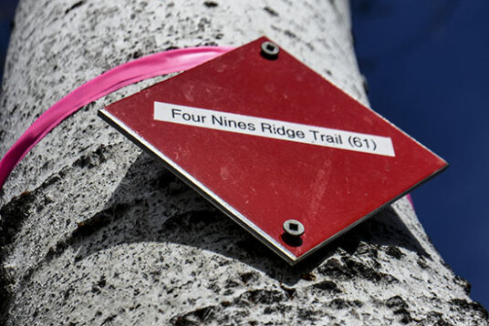
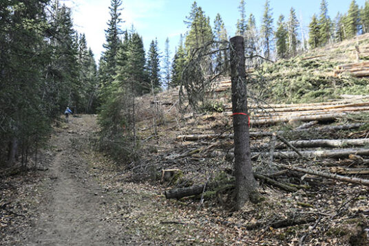
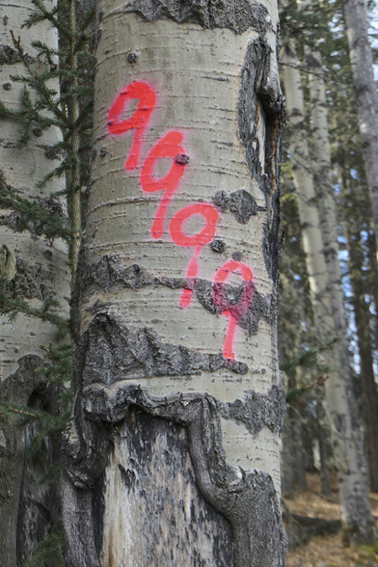
Turn left following flagging and marker trees down a meadow. Cross a haul road and continue along the untouched portion of the ridge to the third top which is all in aspens. Here starts “4Nines Ridge trail ” (according to the equestrians) which simply follows the ridge down to 9999 trail. It’s marked throughout with red 9sR painted on trees and joins 9999 trail at the same place as the NW-SE cutline. Here you’ll find a red marker similar to those found on Mesa Butte. From here I like to visit a popular lunch spot alongside Ware Creek only 370 m distant to the right. Otherwise, head left up 999 trail to the pass.
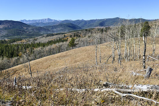
From middle summit is a view of Bluerock Mountain. Marked trail seen here is heading towards the west top and the parking area at the top of the hill on the Ware Creek Road.
From middle top looking towards the east top. Down below in the gap you cross a logging road ithat will be reclaimed in about 3 years time..
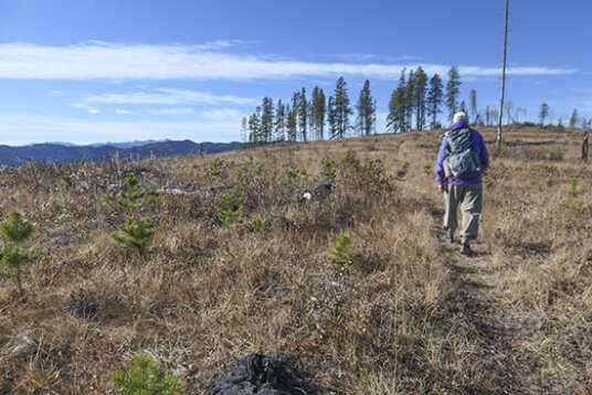
En route to the east top you walk natural meadows.
Entering the aspen woodlands of the east top.
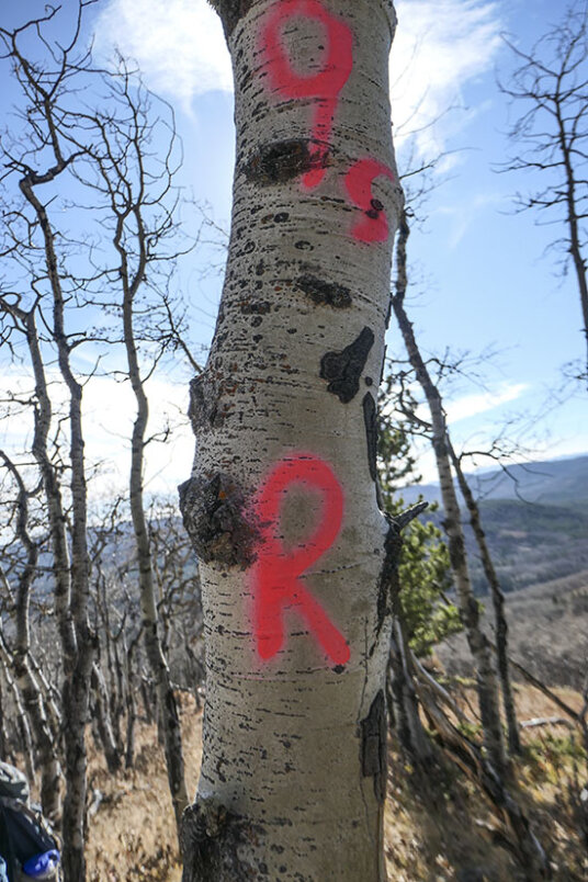
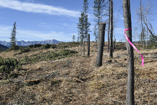
Starting down the ridge towards 9999 trail. Just keep following these red paint marks on trees.
Partway down the ridge are meadows with views across to Sinnot Hill. After a low point, Aspen Ridge rises over a couple of humps then eases off the rest of the way, the going all through aspens with grass underfoot.
Looking up the descent ridge which has steeper sections.
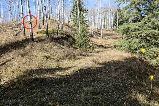
View from the junction with 9999 trail. Red circle denotes the red marker at the bottom of the ridge trail. To right is s cutline.
Close-up of the red marker at the foot of the descent ridge.
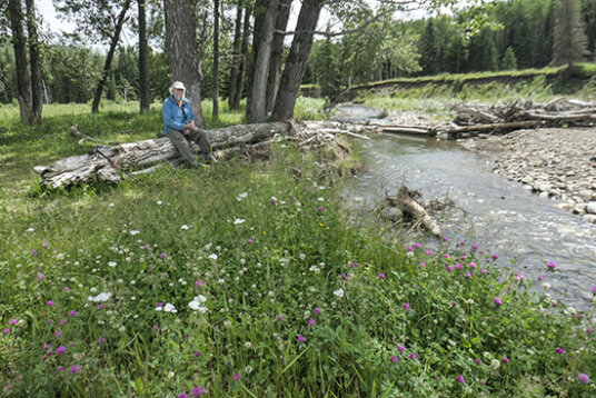
Picnic area by Ware Creek. A small group of poplars offers shade on a hot day.
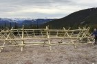
A logging road runs across the pass, slightly disrupting the start to Sinnot Ridge trail. Cross and descend the north slope pretty much as before, although the band of trees to your right is a lot thinner. On entering a cutblock lower down, the trail crosses it, then runs at the right edge almost to the meadow at the junction with Curly Sand. Incidentally, the trail sign at the junction is propped up against a tree to your right.
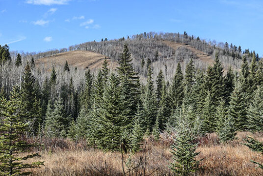
Walking back up 9999 trail from Ware Creek valley is this view of Aspen Ridge.
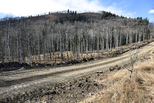
Logging road crossing 9999 pass.
On starting down the north side of 9999 trail is this view of cutbacks on the north slope of Sinnot Hill.
The steepest part of the trail has kept its band of forest on the one side, but the upper slope is now shorn.
Another view of 9999 trail.
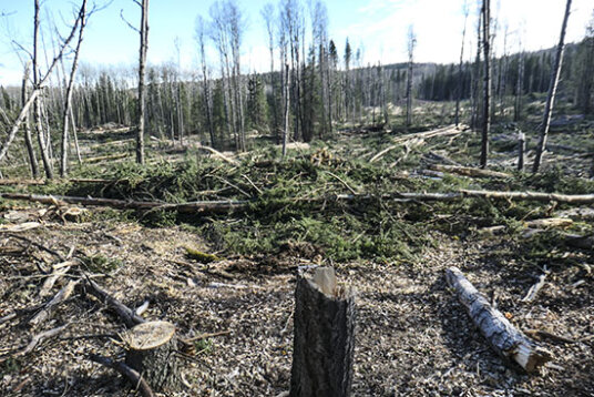
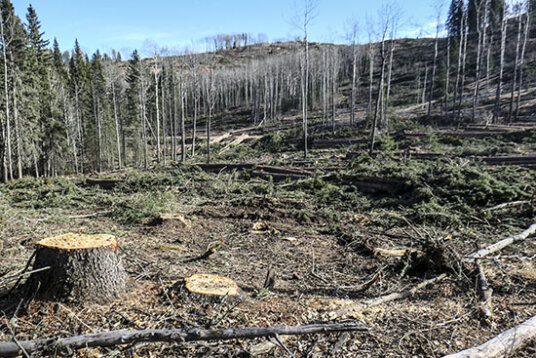
Low down 9990 the trail crosses a big cutblock. This is the view to the east. The view to the west is similar. The trail is still muddy in part (and there is only the one trail now), and will likely need a bit of work done on it after reclamation.
On reaching the junction with Curly Sand in the meadow, you”ll notice the trail sign is missing. (Actually it’s propped up against a tree at the meadow edge.) In its absence, someone (equestrian?) has way marked this tree instead, Of most benefit to hikers doing the loop in reverse or going up onto Sinnot Hill..
Turn left on 9999 to return to your starting point.
Here is a track log of the trail as described here: ![]()
Distance Loop 7.75 From Caledonian installation on the pipeline right-of-way, 8.75 km in winter. From Hwy. 549 via Curly Sand start 8. 75 km year round.


Comments on this entry are closed.
Hi Sonny,
yes it should be SINNOT, though whether this is a hill or a ridge is a moot point. Named in 1914 (Sinnot HILL) after Harry Sinnot who homesteaded below it in Ware Creek. In 1895, during the irrigation survey of the foothills it was used as a camera station called Sinnot 2.
Hi Gill! Is there a consensus on how “Sinnot” is supposed to be spelt? Just in this trip report alone, there are three different spellings (Sinnott, Sinnot, Sinott), and in another snowshoe report, you spelt it “Sinnnot”!