The hiking trails of the High Noon Hills translate well into snowshoe trips ranging from a couple of hours to a half day. And while wandering the meadows and aspen woodlands is enjoyable, what you remember most is the panorama out west to the Front Ranges. Not many foothills give such fantastic views. (See #1 in Volume 4.)

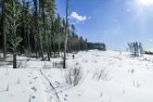
Looking from the second hill to the first hill.
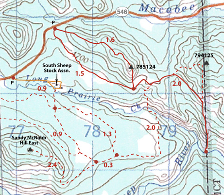
It was well over a week ago that we drove into the Sheep on Hwy. 546 and parked 1.9 km west of the K C boundary at the top of a hill. The trail started out good. In fact, nowadays there seems to be a permanent winter trail to follow used by walkers, snowshoers and skiers that undulates along the northwest ridge to the top of the first hill. The tracks nearly always stop here— a distance of only 2.6 km return.
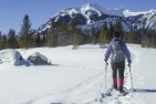
We went on, breaking trail down the steepish south ridge, which sported a little cornice on the lee side, and then left over the saddle to the col at 789123 between the two hills. From here we plodded straight up the face of the second higher hill which is the better viewpoint. En route, we kept mostly in the aspens where the angle was a little less steep. From the top we descended the boundary trail alongside the fence almost to the gate (having overshot the summer trail) before turning back right up to the col. By now the wind was getting up, so on arriving back below the first hill we decided to take the lower route back to the highway, which turned out to be not such a good idea. The snow in the protected meadows was very deep and it all took much longer than if we’d returned over the ridge.
But there’s a trail now, and as there doesn’t seem to have been any new snowfall in the interim, our tracks should still be followable.